Greenway Facts
Approximately 1,400 households live within ¼ mile, and 5,000 households are within 1 mile of the Greenway. Many destinations including schools, shopping centers, medical facilities, and places of worship are within walkable/bikable distance from the Greenway.
MAPS
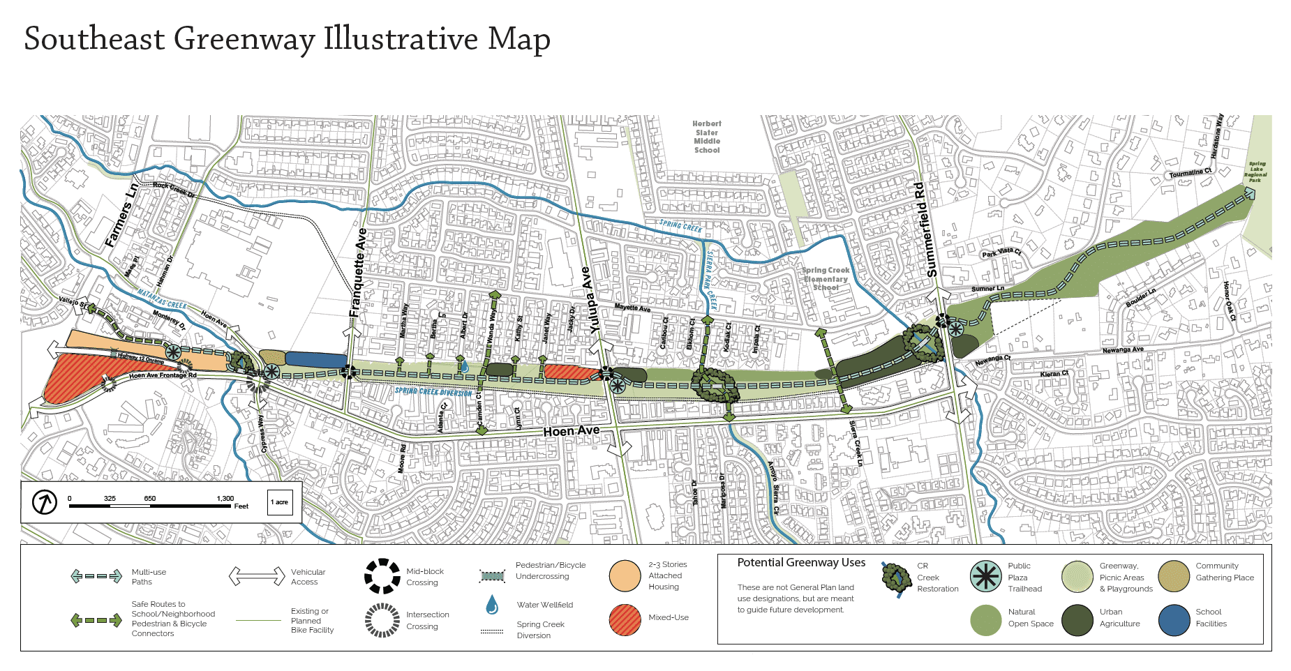
Southeast Greenway Illustrative Map
This map shows the Preferred Land Use and Circulation Alternative that came out of the community planning process and joint City Council – Planning Commission study sessions. The General Plan amendment adopted by the City Council in July 2019 included this map and text policies to provide general uses and standards for future park master planning and specific development proposals.
Caltrans Right-of-Way Corridor for the Southeast Greenway
This is an aerial photograph of the Greenway vicinity with the Caltrans property proposed for the Greenway shown in green. The picture clearly shows the undeveloped two-mile corridor surrounded by urban development that has taken place since Caltrans purchased the right-of-way in 1959-72.

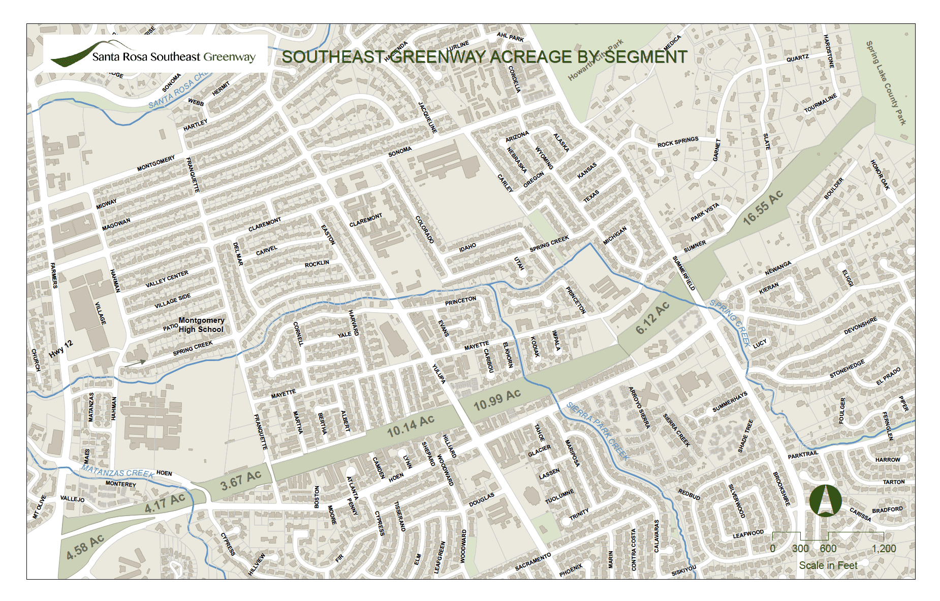
Southeast Greenway Acreage by Segment
This map, prepared by GIS professional Peter Dellavalle, shows the number of acres for seven segments of the Greenway and the existing buildings, lot lines, street names, and streams in the surrounding area.
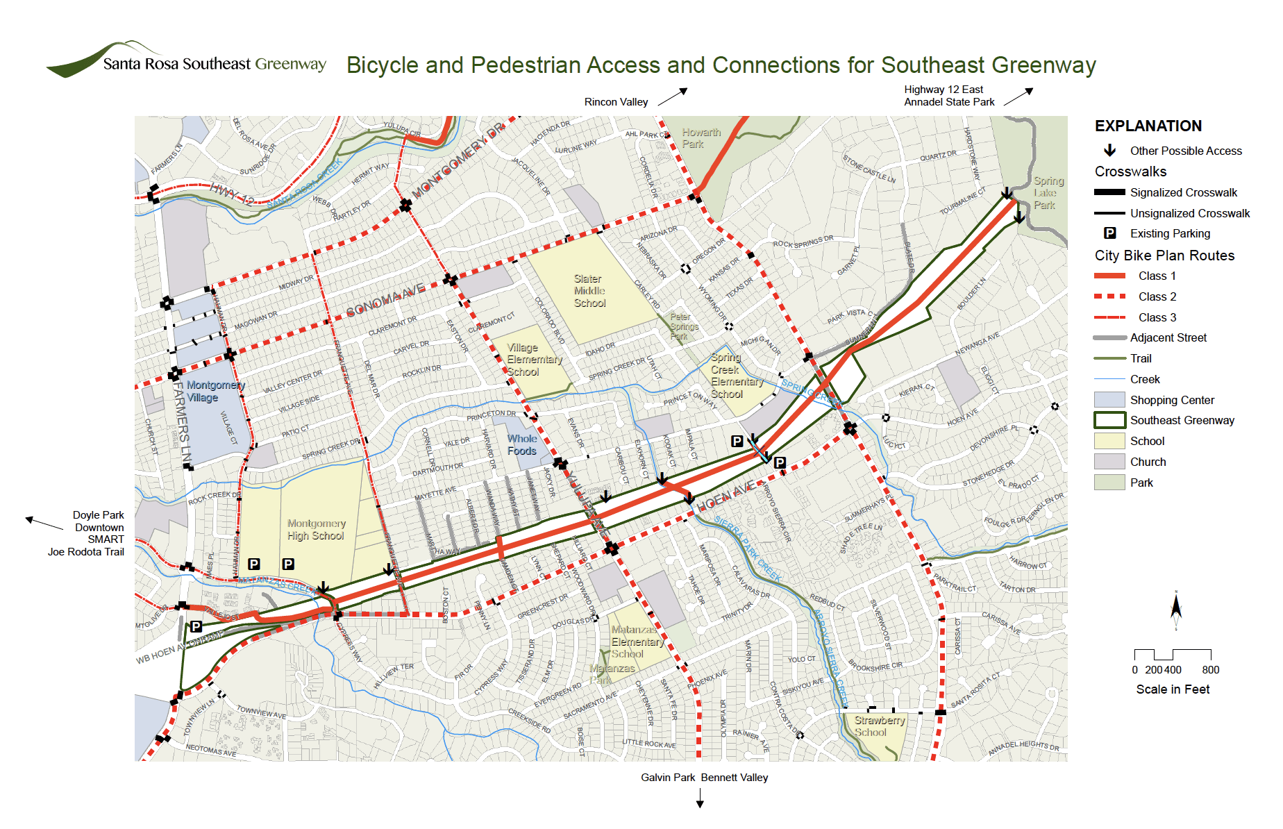
Bicycle and Pedestrian Access and Connections for Southeast Greenway
This map, prepared by Peter Dellavalle and Bob Gaiser, shows the existing streets, parking lots and access points adjacent to the Greenway and the bike routes designated in the City of Santa Rosa’s 2019 Bicycle-Pedestrian Master Plan for the Greenway area. A Class 1 bicycle path is proposed for the planned Greenway multi-use path from Vallejo Street to Spring Lake Park and for the three planned north-south multi-use paths crossing the Greenway.